
Alexandria Map Society Meeting Explores George Washington’s Maps—and the Town He Drew at 17
Mount Vernon historian Alexandra Montgomery will discuss Washington’s life with maps during the society’s Oct. 27 program at Charles Houston Recreation Center.
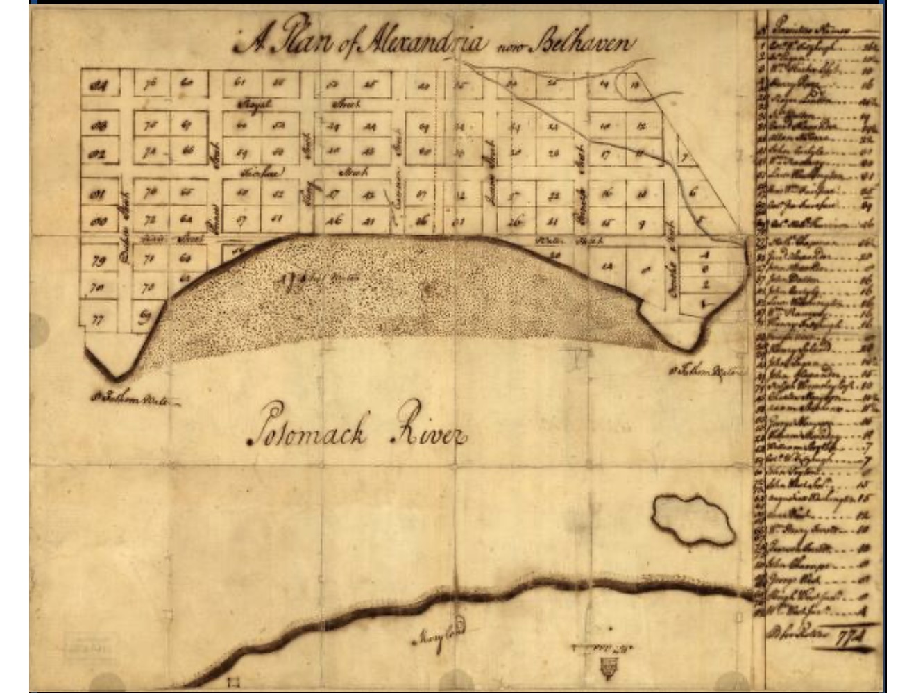
ALEXANDRIA, VA—Most teenagers today navigate with a phone. George Washington was drawing the map.
In 1749, at just 17, the future president put Alexandria on paper, recording the young town’s street grid, numbered lots and property owners. His handwritten plan survives at the Library of Congress, a reminder that long before Washington became a face on our money, he was a young man learning to measure the ground beneath his feet.
That lesser-known Washington takes center stage Tuesday, Oct. 27, when the Alexandria Map Society presents “George Washington’s Maps” from 6 to 7 p.m. at the Charles Houston Recreation Center.
Alexandra L. Montgomery, Ph.D., director of the Center for Digital History at the George Washington Presidential Library, part of the Mount Vernon Ladies’ Association, will explore how Washington used maps in surveying, military planning, managing land and understanding early America. The program is for society members, and newcomers can join before registering.
Alexandria, in a teenager’s handwriting
For anyone who loves Old Town, Washington’s early Alexandria map offers a particularly satisfying rabbit hole.
Titled “A plan of Alexandria, now Belhaven,” it depicts a town laid out in 84 lots and 10 streets. Alongside the plan are purchasers’ names, lot numbers and prices—details the Library of Congress says suggest it may have been used during the July 14–15, 1749, sale of town lots.
Think of it as a very early look at Alexandria real estate, minus the listing photographs and granite-countertop descriptions.
There is even a small surprise in the accounting: the lot prices were recorded in Spanish pistoles, a form of currency, rather than Virginia or British money. And anyone accustomed to north appearing at the top of a map will need to adjust. On this one, north points to the right.
It is the kind of document that invites you to linger. Before the restaurants, boutiques and familiar bustle, there were lines on paper, names beside parcels and a town beginning to take shape.
His first career came with a compass
Surveying was Washington’s first profession. Mount Vernon describes his early work as a foundation for a promising career while he was still a teenager.
In July 1749, he became the official surveyor of Culpeper County. Between 1749 and 1752, he completed 199 professional land surveys, according to the Library of Congress, with much of that work taking him into the northern Shenandoah Valley.
The tools and habits of that work followed him into a much larger life. Mount Vernon notes that Washington continued creating and using maps as both a surveyor and a military leader. Montgomery’s presentation will examine that broader relationship: how maps helped him understand property, plan military operations and make sense of the geography of a developing nation.
For Alexandria residents, the connection is unusually close to home. One way to meet the young Washington is to look at a map—and discover he was already looking at our town.
More territory to explore
The society’s announced lineup continues with a Dec. 1 online program on mapping loyalty during the American Revolution, featuring Clinton Drake of the Library of Congress.
Programs planned for 2027 will explore tactile and Braille maps with Alice O’Reilly on March 30, ocean mapping with Columbia University scientist Vicki Ferrini on April 27, and Alexandria city planning with the city’s Neighborhood Planning and Community Development team on June 29.
IF YOU GO
What: “George Washington’s Maps,” presented by the Alexandria Map Society
When: Tuesday, Oct. 27, 2026, 6–7 p.m.
Where: Charles Houston Recreation Center, 901 Wythe St., Alexandria
Admission: Members-only program; advance registration required. Annual membership is $50 for individuals or $25 for students and educators. New members may join and then register.
Join: alexandriamapsociety.org/join
Register: George Washington’s Maps event page
Questions: [email protected]


