What’s Next for Duke Street? Alexandria Releases Draft Plan and Seeks Public Input by Nov. 13
The City is seeking public feedback on a long-range vision for the corridor, from Alexandria Union Station to the West End. Comments submitted by Nov. 13 can inform the draft prepared for December hearings.
ALEXANDRIA, VA — What should Duke Street look like in the decades ahead? Alexandria residents, property owners and businesses now have a chance to weigh in on the City’s newly released Draft Duke Street Land Use Plan, which could shape future development along one of the city’s busiest corridors.
The full draft was unveiled at a Sept. 29 community meeting at Patrick Henry Recreation Center. The City announced Friday, Oct. 9, that public comments submitted through Nov. 13 can be incorporated into the version prepared for December public hearings.
What Is at Stake on Duke Street?
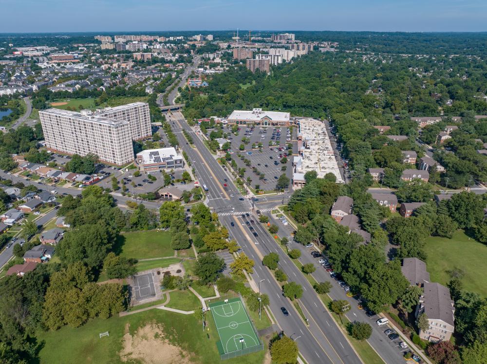
The planning area stretches from Alexandria Union Station west toward Van Dorn Street and the redevelopment of the former Landmark Mall site. The corridor’s land-use vision has not received a comprehensive update since 1992, according to the City.
The City’s planning materials identify approximately 600 small businesses along the corridor and the roughly 2,100-unit Foxchase development among the important resources to consider. Rather than announcing construction at specific addresses, the proposed plan would establish a framework for how future development applications are evaluated.
What Changes Are Being Proposed?
The City’s published draft recommendations and land-use maps describe several concrete changes. Details for individual properties depend on the proposed district maps, and the recommendations remain subject to public comment and City approval.
- More housing and potentially taller buildings: The plan identifies growth and opportunity areas where additional residential density and height could be considered, particularly along Duke and Van Dorn streets. Taller buildings would be paired with transitions to lower-scale neighborhoods. The proposed corridor is organized into 12 planning districts with different development expectations.
- Affordable-housing requirements: In designated Affordability and Growth Areas and Opportunity Areas, the working draft calls for 10% of residential development above base zoning to be committed affordable housing, or a greater amount if applicable City policy requires it. For rental units in Affordability and Growth Areas, the draft specifies affordability at 60% of area median income. The City also calls for preserving existing committed and market-affordable housing, an especially significant issue for longtime renters.
- New parks and greener connections: Future redevelopment would help create publicly accessible parks, connected walking routes, linear greenways and more tree canopy. The draft encourages preservation of mature trees and an approximately 16-acre wooded area near the rail corridor.
- Changes to streets and crossings: The proposed network includes new local streets, pedestrian and bicycle connections, intersection safety studies and better links among neighborhoods and open spaces. One option discussed in coverage of the full draft is converting the Liebach Bridge near Beatley Central Library to pedestrian, bicycle and scooter use.
- Different expectations for new buildings and businesses: The working draft generally discourages new surface parking lots, favors ground-floor retail in designated areas, calls for varied building heights and facades, and sets a general 300-foot building-length guideline. Temporary uses of vacant storefronts and underused parking areas would be encouraged before permanent redevelopment.
These examples are highlights, not an exhaustive list of proposed changes. Readers should review the complete Draft Duke Street Land Use Plan, including Chapter 9’s district-by-district maps, recommendations and development guidance, to see what is proposed for their own neighborhood or property. The full document is available to read online or download through the City’s engagement hub.
These are proposals, not approved rezonings or construction permits. A future redevelopment would still have to go through applicable City review processes. Residents can also submit comments on the full plan through November 13 for inclusion in materials prepared for December hearings.
For residents, the biggest questions are likely to be how much additional development would be allowed, what protections would exist for affordable homes and small businesses, and whether new parks and pedestrian connections would arrive alongside growth. The City says the goal is a coordinated long-range vision rather than reacting to each project separately.
Not the Same as Duke Street In Motion
One distinction matters for residents who have followed the debates over bus lanes and traffic. The Duke Street Land Use Plan is separate from Duke Street In Motion, the transitway project approved in 2023. According to the City’s frequently asked questions, the land-use process will take the approved transitway plans into account but will not reopen or revise them.
How Residents Can Have Their Say
Residents can read the full draft and comment through the City’s online engagement hub. The City has also scheduled virtual office hours on Oct. 14 at 4 p.m., Oct. 20 at 5 p.m., Oct. 26 at noon, Nov. 4 at noon and Nov. 10 at 4 p.m. Registration links are available on the official project page.
Community organizations, civic associations and condominium or homeowners associations can also request a presentation and question-and-answer session with planning staff.
To comment directly, contact Christian Brandt of the City’s Department of Planning and Zoning at [email protected] or 703-746-3859.
Important: The City will continue accepting comments after Nov. 13, including at the December public hearings. But comments arriving later will not be incorporated into the revised draft and docket materials prepared for those hearings.
If You Want to Participate
What: Duke Street Land Use Plan draft feedback period
Deadline for inclusion in updated hearing materials: Friday, Nov. 13, 2026
Next virtual office hours: Wednesday, Oct. 14, 4 p.m.
Plan and meeting links: alexandriava.gov/DukeStreetPlan
Online feedback: Duke Street Engagement Hub
Sources: City of Alexandria Duke Street Land Use Plan project page; City’s published working draft recommendations and maps; full September draft and district maps; City’s Oct. 9 eNews release; and ALXnow’s Sept. 30 reporting on the released full draft. The earlier working recommendations have not yet been exhaustively compared line by line with the full September plan; individual parcel-specific height and land-use changes require additional verification against its maps.