
The Small Stone That Marked the Start of Washington, D.C.—and Why it’s in Alexandria
At Jones Point Park, a 1791 boundary marker beneath a protective grate reveals Alexandria’s overlooked role in creating the nation’s capital.
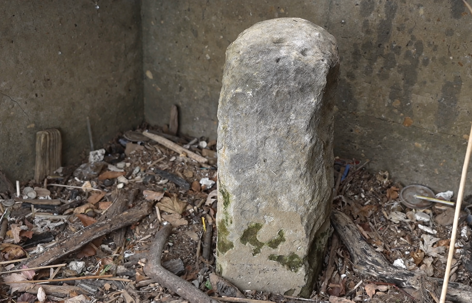
ALEXANDRIA, VA — One of the most consequential stones in American history is hiding in Alexandria—under a grate, near the Potomac, and easy to miss even when you are standing practically on top of it.
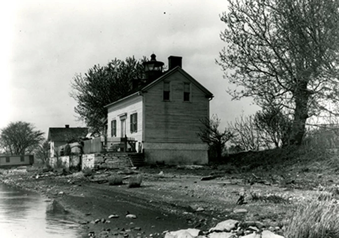
Jones Point Park has the ingredients for a perfectly ordinary waterfront stroll: river views, the old lighthouse, room to walk. Then history pulls a tiny prank. The first stone you notice is not the real one.
The original is farther toward the water. Brush aside the leaves around an old protective grate and look down. There, below the surface, is the weathered South Cornerstone, set in 1791 to begin the survey of the federal district that would become Washington, D.C.
In other words, before there was the White House, the Capitol dome, or even a city called Washington, there was a stone in Alexandria.
Not a City Map—A Giant Diamond
The Constitution gave Congress authority over a national seat of government “not exceeding ten Miles square.” That phrase sounds almost quaint until you see what it produced: a 100-square-mile diamond, tilted on the map, with the Potomac cutting through it. Virginia contributed the western portion; Maryland contributed the rest.
President George Washington’s 1791 proclamation located the starting point at “Jones’s point, the upper cape of Hunting Creek in Virginia.” Surveyor Andrew Ellicott’s team began from that point and set 40 sandstone markers around the diamond over 1791 and 1792. Benjamin Banneker, the free Black astronomer and mathematician whose work helped establish the initial survey line, was part of the early effort to locate the boundary.
That makes the stone at Jones Point less like a relic from the edge of town and more like the first pushpin in a very large national project.
There is another wonderful local footnote. The April 1791 ceremony at the point was a Masonic affair involving Alexandria’s lodge and the federal commissioners. Washington had visited the location the month before, but the story is not one of the president dramatically dropping the stone into place. It is the more interesting truth: a new capital was taking shape through surveyors, local civic leaders, ritual, calculations, and a lot of careful measurement.
The Map That Reads Like a Treasure Hunt
More than a century later, mapmaker Fred E. Woodward drew what may be the most entertaining piece of boundary-stone documentation ever made. His 1906 Chart Showing the Original Boundary Milestones of the District of Columbia, preserved by the Library of Congress, rings the old diamond with tiny obelisks and location notes.
Some are conventional. Others have the chaotic charm of a scavenger hunt compiled by a very serious person with very little time: “Stump only.” “Stump in ground.” “Missing.” One marker is listed as being “in yard of 1200 Wilkes St.” It is proof that historical preservation has always involved a little shrugging and pointing.
Thirty-six of the original 40 markers survive, according to the Library of Congress’s boundary-stone history—an astonishing number for a set of little sandstone monuments that has spent more than two centuries near roads, yards, woods and changing city limits. Some still carry inscriptions such as “Jurisdiction of the United States.” Others have been worn down, swallowed by landscaping or tucked behind protective fences.
So yes: there is a genuine local quest hiding in plain sight. Find one boundary stone and you have found an artifact from the exact moment the United States drew the line around its future capital.

Why Alexandria Is Not Alexandria, D.C.
The South Cornerstone also explains one of Alexandria’s best alternate-history questions. For decades, Alexandria was inside the federal district. Beginning in 1801, the city was governed by Congress alongside the rest of the District of Columbia.
That arrangement became a sore point. Alexandria residents had no voting representation in Congress, and many believed the money, attention and major federal construction were flowing to the Maryland side of the Potomac. After years of argument, Congress approved the return of Alexandria County to Virginia in 1846; Virginia formally accepted it in 1847.
That is the short answer to “Why aren’t we Alexandria, D.C.?” We were—until residents decided the arrangement was not working out. Even 19th-century breakup stories had arguments about money, attention and representation.
Jones Point is a nice place to let that sink in. From this quiet riverbank, Alexandria helped establish the boundaries of the capital, spent decades inside them, and then became the only part of the original District returned to its former state.
See the Real One for Yourself
For the satisfying visual reveal—the decoy marker, the walk toward the river and the grate—Alexandria History Tours founder Tim Rose takes viewers right to the spot in the video below. Consider it the field guide after the story, not a substitute for looking closely at Jones Point yourself.
The Zebra Press and Alexandria History Tours are media partners. We will occasionally pair a video from Rose’s archive with additional Zebra reporting, archival context and the kind of local-history rabbit holes that make a weekend walk more interesting.
IF YOU GO
Where: Jones Point Park, 125 Jones Point Drive, Alexandria, VA 22314
What to look for: The 1791 South Cornerstone beneath a protective grate near the waterfront. Start with the video above if you want a visual field guide.
Worth knowing: Please respect the protective grate and the historic site—look, photograph and leave the stone exactly as you found it.


