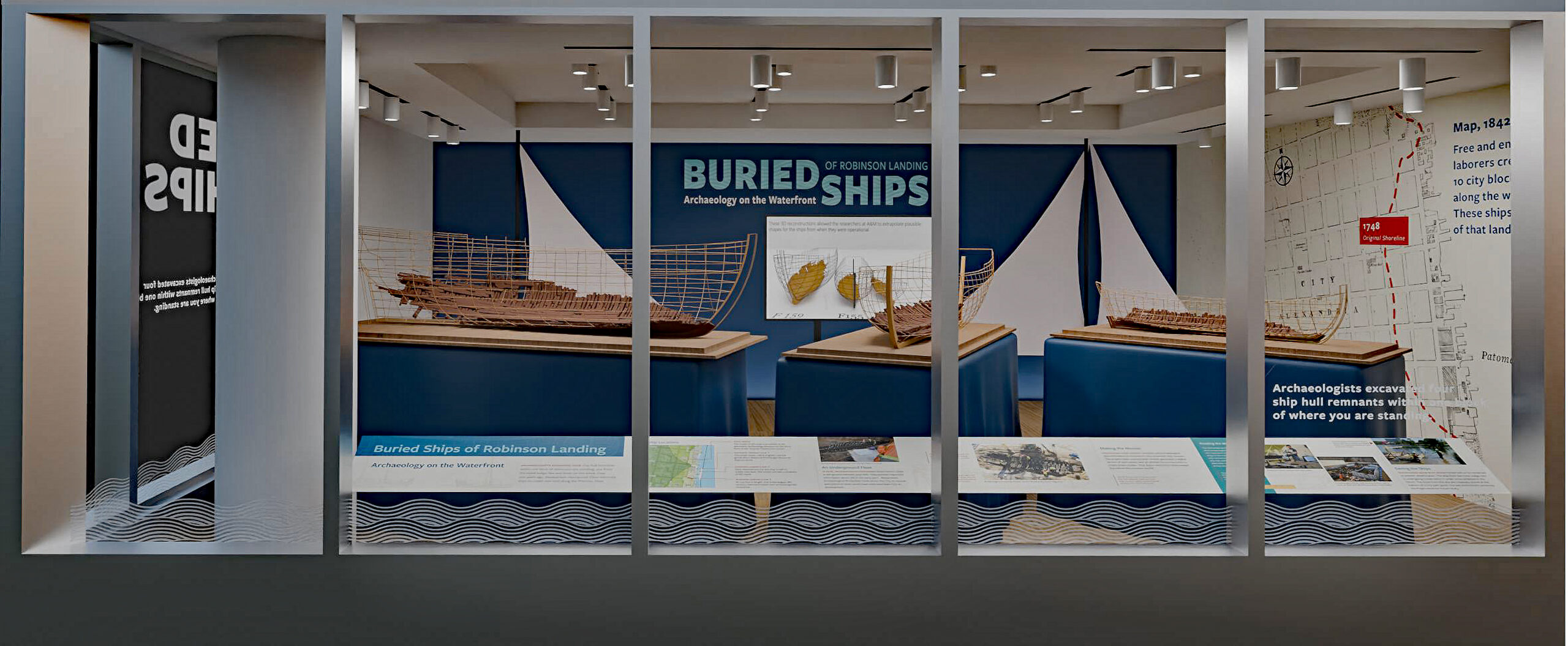
Alexandria, VA – For the first time, see three scale models of historic ships at the location where archaeologists first discovered their hull remains. View ship construction through the eyes of archaeologists in the new exhibit from Alexandria Archaeology, Buried Ships of Robinson Landing. A ribbon cutting for the exhibit takes place on April 6 at the corner of the Strand and Pioneer Mill Way.
In 2018, archaeologists excavated the three historic vessels from the Robinson Landing site on the same block as the new exhibit. Through an exciting partnership with the Robinson Landing Property Owners Association, Alexandria Archaeology has the unique opportunity to shine a light on this site’s history. These innovative scale models show what these ship remnants would have looked like in the late 18th and early 19th centuries. Archaeologists use these digital and physical models to compare ship construction and to answer questions about the age and use of the vessels. The exhibit is viewable from the sidewalk through the end of the year.
Currently bounded by Duke, Wolfe, and S. Union Streets and the Potomac River, only the northwest corner of the block existed as dry land when a young George Washington mapped this area in 1748. This point of land was called Point Lumley, one of the two original deep-water landings in Alexandria. The same late 18th and early 19th-century banking-out process that created new land along Alexandria’s waterfront created the remainder of the block.
The remains of the three actual ships are now stored in a pond in a manner that preserves the possibility of future study and conservation when adequate funding and/or a location for permanent storage or display is available. You can learn more about the Historic Ship Stabilization Project at alexandriava.gov/archaeology/historic-ship-stabilization. Planning for the storage of the historic ship timbers began shortly after the ships were discovered in 2018. The implementation and fieldwork phase began in January 2021 and was completed in May 2022.