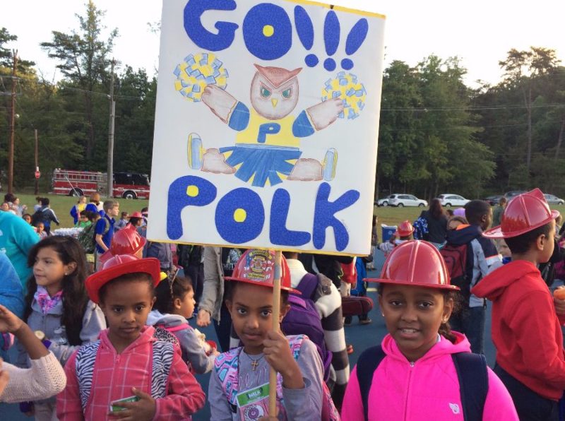
Transportation

Find Out When Your Street Will Be Repaved! Alexandria Releases Plan To Fix Roads

Photo: iStcck.com/06photo

ALEXANDRIA, VA – In today’s Council Connection newsletter, the mayor addressed road conditions in Alexandria. The city is responsible for 561 lane miles of roads. The city manager’s proposed budget, the mayor wrote, allocates $5.1 million for FY 2024, as well as ($63.2 million for the next ten years for paving.

If the proposed budget is approved the following roads will be repaved next fiscal year (beginning July 1):

  • Parkway Terrace from West Timber Branch Parkway to End
  • Clyde Avenue from East Bellefonte Avenue to East Uhler Avenue
  • Price Street from East Bellefonte Avenue to End
  • West Mount Ida Avenue from Commonwealth Avenue to Russell Road
  • East and West Del Ray Avenue from Russell Road to La Grande Avenue
  • Sanford Avenue from West Dale Ray Avenue to End
  • Ruffner Road from west Braddock to High Street
  • West Timber Branch Parkway from Ruffner Road to Junior Street
  • Cameron Station Boulevard from Duke Street to South Pickett Street
  • Hermitage Court from King Street to End
  • Green Street from South Patrick Street to South Lee Street
  • Cloverway Drive from Dartmouth Road to Janneys Lane
  • Robinson Court from Janneys Lane to End
  • Holland Street from Duke to Eisenhower Avenue
  • Dale Street from Edison Street to End
  • Oakley Place from East Timber Branch Parkway to End
  • Orleans Place from North Gailand Street to End
  • Ormond Avenue from North Gailand Street to North Howard Street
  • Sylvan Court from Trinity Drive to End
  • Stevenson Avenue from South Whiting Street to Stulz Road
  • North Stevenson Square from Stultz Road to End
  • South Stevenson Square from Stultz Road to End
  • Edison Street from West Reed Avenue to End
  • North Clarens Street from Trinity Drive to End
  • North Breckinridge Place from Lincolnia Road to End
  • Oakville Street from Swann Avenue to Fannon Street
  • Fannon Street from Richmond Highway End
  • Juliana Place from North Pickett Street to End
  • North Breckinridge Place from Lincolnia Road to End
  • East and West Mason Avenue from Stonewall Road to End
  • Roberts Lane from Duke Street to End
  • East and West Uhler Avenue (Entire Length)
  • North Pelham Street from Holmes Run Parkway to Taney Avenue
  • North Terrill Street from Richenbacher Avenue to End
  • North Vail Street from Richenbacher Avenue to End
  • Fort Worth Avenue from Fort Williams Parkway to End (Fort Worth Place)
In FY 2025, from July 2024 to June 2025, these roads are scheduled to be repaved:
  • Seay Street from Longview Drive to End
  • Viewpoint Road from Longview Drive to End
  • Emerson Avenue from John Carlyle Street to Holland Lane
  • Wilkes Street from South Patrick Street to End
  • Mayer Place from Allison Street to End
  • Juniper Place from North Jordan Street to End
  • Milan Drive from West Glebe Road to Four Mile Road
  • West Windsor Avenue from Russell Road to Commonwealth Avenue
  • Herbert Street from Commonwealth Avenue to Mount Vernon Avenue
  • Manning Street from Commonwealth Avenue to Clifford Avenue
  • North and South Lee Street Entire Length
  • North Garland Street from Fort Worth Avenue to End
  • Sharp Place from Saint Stephens Road to End
  • Vicar Lane from Bishop Lane to End
  • Adams Avenue from Newton Street to Mount Vernon Avenue
  • Newton Street from East Braddock Road to East Luray Avenue
  • Gunston Road from Valley Drive to Valley Drive
  • Elizabeth Lane from Eisenhower Avenue to Courthouse Square
  • Metro Road from Eisenhower Avenue to South Van Dorn Street
  • Boyle Street from Buchanan Street to End
  • Second Street from Colonial Avenue Drive to North Fairfax Street
  • Laird Place from Manor Road to Tennessee Avenue
  • Stovall Street from Eisenhower Avenue to Mill Road
  • South Bragg Street from City limit to End
  • Ford Avenue from North Hampton Drive to End
  • Banks Place from North Morgan Street to End
  • Franklin Street from South Union Street to South Payne Street
  • Commerce Street from South Fayette Street to South West Street
  • Fern Street from North Quaker Lane to Osage Street
  • Imboden Street from North Howard to Raleigh Street
  • Sanford Street from West Mount Ida to West Del Ray
  • Price Street from East Bellefonte Avenue to Cliff Street
  • Ballenger Avenue from Holland Lane to Courthouse Square
  • South Royal Street from Gibbons Street to Queen Street
  • Slaters Lane from Richmond Highway to End
  • Portner Road from Slaters Lane to End
  • Portner Place
In FY 2026, from July 2025 to June 2026, these roads are scheduled for repaving:
  • Calvert Avenue from Richmond Highway to Murrays Avenue
  • Cloverway Drive from Janneys Lane to Dartmouth Road (Clovercrest Drive)
  • Dearborn Place from Fort Williams Parkway to end
  • Pryor Street from Richenbacher Avneue to Taney Avenue
  • Regency from North Pryor to End
  • Rhoades Place from North Pryor to End
  • Peele Place from Taney Avenue from End
  • Moore Place from Pullman Place to End
  • Pullman Place from Cameron Mills Road to End
  • Summit Avenue from Cameron Mill Road to Dogwood Drive
  • Hillside Terrace from Crest Street to Valley Drive
  • Louis Place from North Howard Street to End
  • Hare Court from Louis Place to End
  • Featherstone Place from Fortworth Avenue to End
  • Hatton Court from Doris Drive to End/Partial Doris Drive (city limit)
  • Hawthorne Avenue from Hatton Court to Holmes Run Parkway
  • Holmes Run Parkway from North Chambliss to End
  • Mill Road from Jamieson Avenue Eisenhower Avenue
  • Peachtree Place from Gailand Street to End
  • Rapidan Court from Polk Avenue to End
  • Canterbury Lane from Trinity Drive to End (Chancel Place)
  • Trinity Drive from Fort Williams Parkway to End
  • North Fayette Street (600 Block) Concrete Restorations
  • Fayette Street from Duke Street to End
  • Kingston Avenue
  • Kingston Place
  • North Peyton Street
  • Madison Street from West Street to End
  • Oronoco Street from Earl Street to End
  • Commonwealth Avenue from Mount Vernon Avenue to End
  • Mount Vernon Avenue from West Glebe Road to the City Limit
  • Business Center Drive
  • East Abingdon Road
  • West Abingdon Road
  • Walleston Court

The Transportation and Environmental Services Department assesses road conditions every three years. Condition is based on a score from the Pavement Condition Inventory (PCI). The pavement plan is determined using PCI scores and available resources. However, the plan is subject to change as a result of other projects and work utility work.

3 Alexandria High School Wrestlers Make State Championships in Virginia Beach

0 0 votes
Article Rating
Subscribe
Notify of
guest

This site uses Akismet to reduce spam. Learn how your comment data is processed.

0 Comments
Oldest
Newest Most Voted
Inline Feedbacks
View all comments

Kevin Dauray

Kevin was a writer and editor with The Zebra Press. He worked for Alexandria's "Good News" newspaper from 2019 - 2025. A graduate of George Mason University, he earned a bachelor's in English with a concentration in Creative Writing. He also studied at the Columbia School of Broadcasting and holds a master's degree in Clinical Mental Health Counseling from Marymount University. He is an alumnus of T.C. Williams High School. Go Titans!

Related Articles

0 0 votes
Article Rating
Subscribe
Notify of
guest

This site uses Akismet to reduce spam. Learn how your comment data is processed.

0 Comments
Oldest
Newest Most Voted
Inline Feedbacks
View all comments
Back to top button
0
Would love your thoughts, please comment.x
()
x